Class Of 1959
Eastern Howe Neighborhood
Eastern Howe
A glorious spring day made for an enjoyable walk through the eastern part of the Howe neighborhood, including the Mississippi River bluff. Indeed, I enjoyed the walk so much that I didn’t take as many photos as usual. Perhaps that’s just as well. Regular readers will already have seen quite a bit of the neighborhood from the southwestern, northwestern, and north central sections.
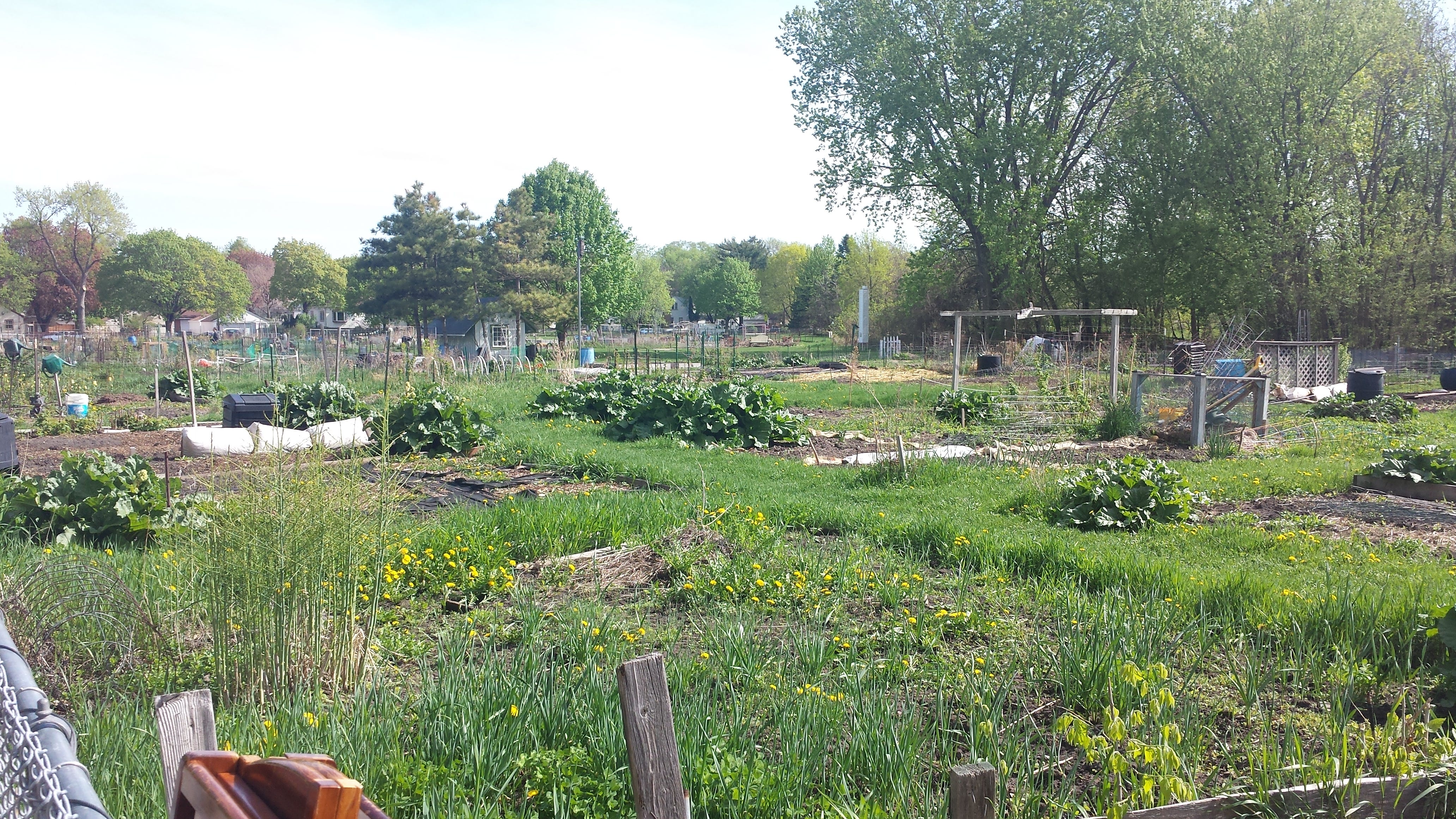
Starting out southbound on 46th Avenue South from 38th Street East, I soon passed along the western side of the Dowling Community Garden, which has an unusually deep and well-documented history. I also noted the signs advertising an annual plant sale, May 19, 2018, 10am to 1pm.

Once I reached 40th Street East, I retreated to 39th. (That forward and back spur, like all the others, is shown in red on the route map.) That let me catch the 3900 block of 45th Avenue South, which I had previously omitted. Returning eastbound on 40th Street to its intersection with 46th Avenue, I continued onto Coffey Lane, which together with Folwell Drive takes the place of 40th Street in the easternmost part of the Howe/Hiawatha neighborhood border. I accidentally included some houses from the Howe side of the street in my earlier post about Hiawatha, but I’ll repeat one of those houses now because it is an architecturally significant one and I was able to get a better photo this time.


Turning north on Edmund Boulevard brought me alongside the Michael Dowling School, an urban environmental magnet school. In the days before schools generally accommodated students with disabilities, the Dowling school specialized in educating students with physical disabilities, starting in 1920 at another site and moving here in 1924. This also explains the name.


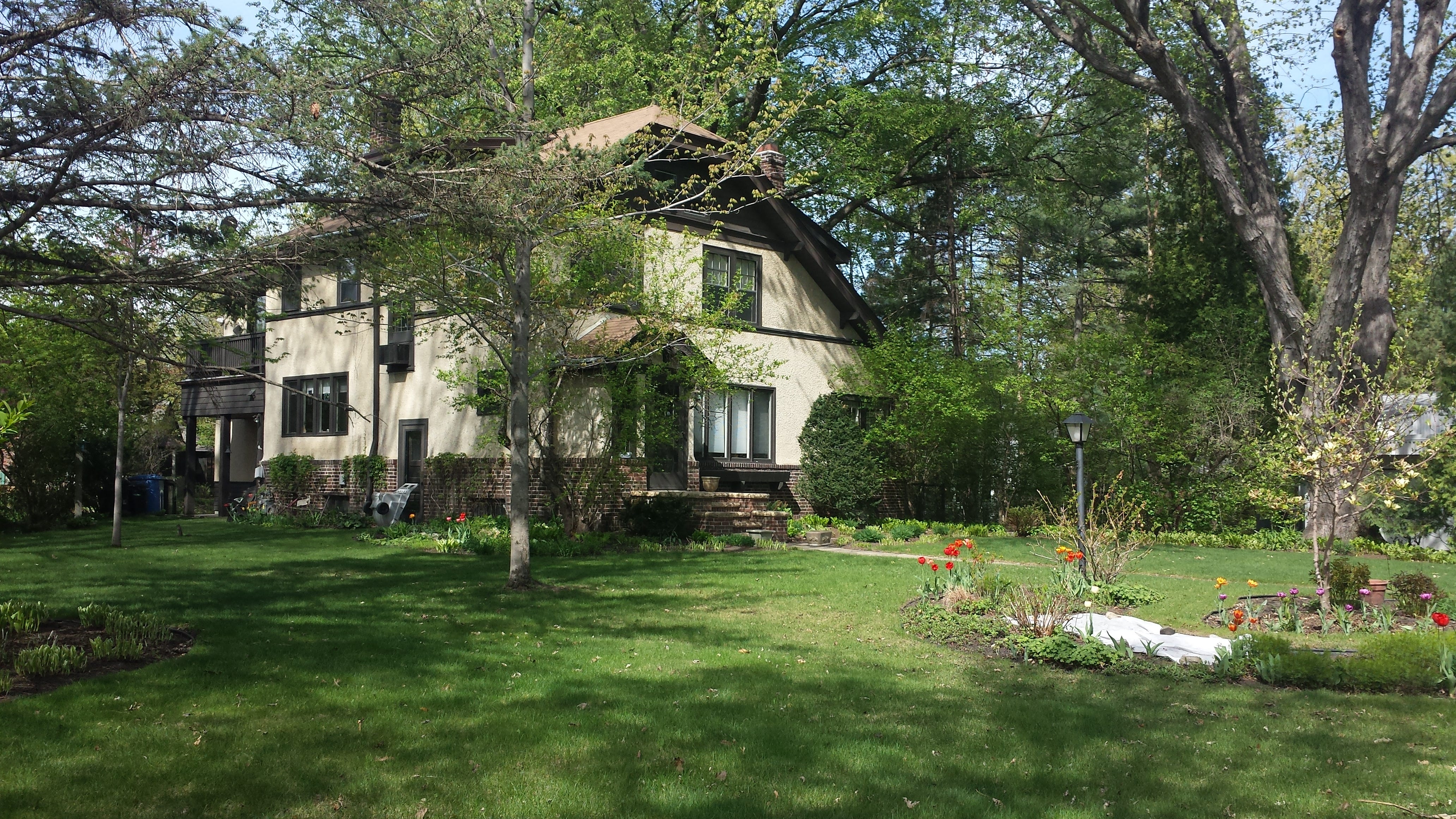
At the point where Glabe Lane would intersect Edmund Boulevard, a two-story arts-and-crafts house was built in 1924 for the Rev. Edwin Buckley Glabe and his family. As explained at the end of the previous walk, he played an important role in the history of this area, as well as in the lives of many children.

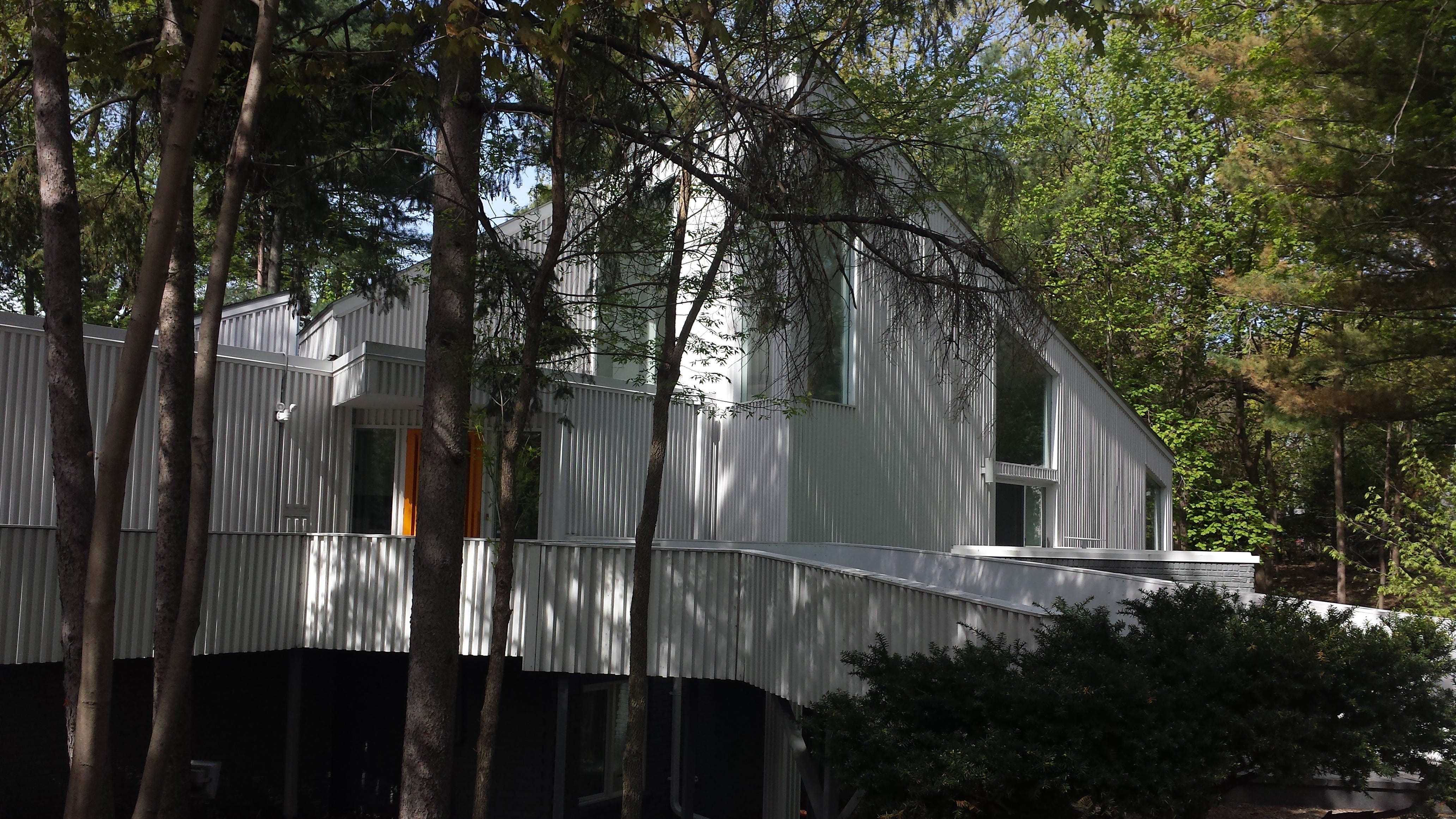
The two houses to north of the Glabe house, between it and 36th Street East, are considerably newer (1973) and serve as another reminder of the former orphanage, as with the houses of that period I saw on Glabe Lane. The southern one (3616) is considerably more complex and so I wasn’t able to do it justice with any one photo. Happily, the Star Tribune provides several more in an article by Kim Palmer. That same article explains that architect Arthur Dickey was commissioned to design the house in the shape of a Star of David.


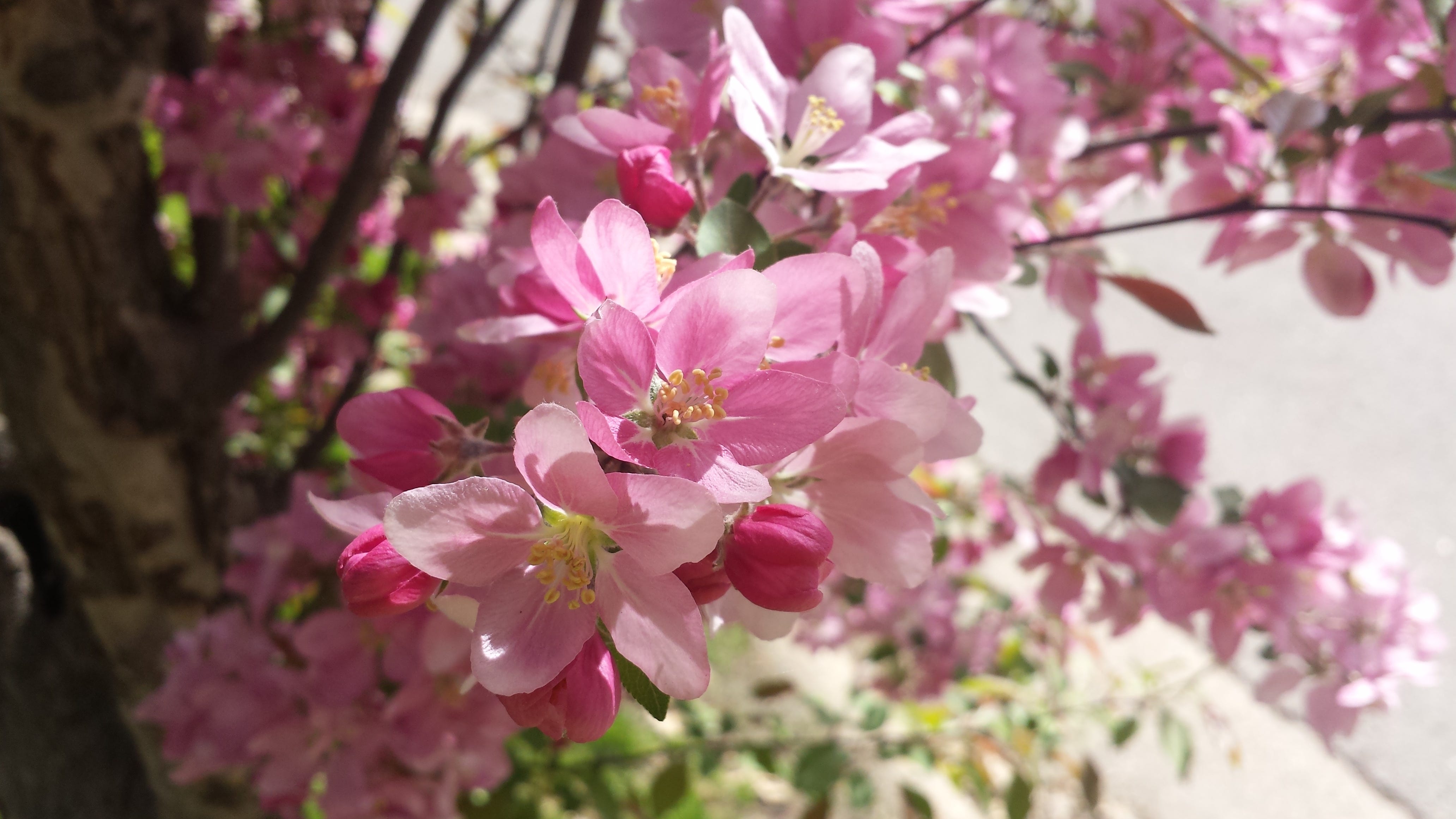
Recall, though, that this was not merely a historical tour of architecture and of the prior arrangements for disadvantaged youths. It was also a Sunday stroll on a beautiful day in May. And so I paused to appreciate the flowers.

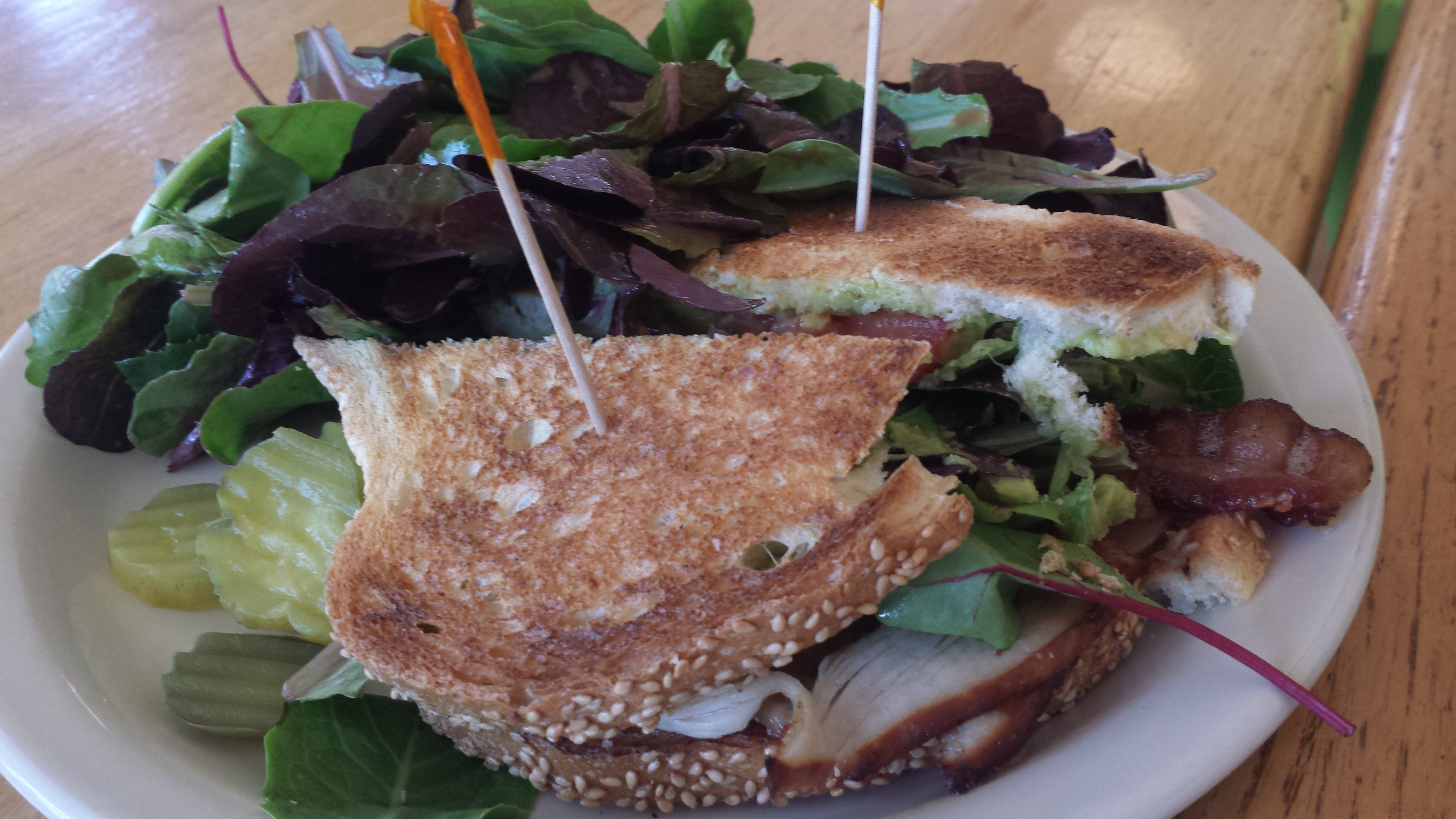
Turning west from Edmund Boulevard onto 34th Street East, I zigged and zagged back and forth between 34th and 36th Streets East until I arrived at the corner of 34th Street East and 42nd Avenue South. That’s where Turtle Bread Company has their Longfellow branch. (Longfellow is the broader community that encompasses the Howe neighborhood. It’s also the name of another constituent neighborhood, but here it is used in the broader sense.)
I previously photographed this bakery and restaurant from across the street, but now I had the opportunity to enter the tastefully decorated interior. Life being uncertain, I started with a slice of strawberry rhubarb pie, then progressed to the Wadsworth sandwich, presumably named for Henry Wadsworth Longfellow. The pie filling was the perfect mixture of tart and fruity. Some other pie makers mistakenly think they need to add a lot of sugar to balance out the rhubarb. But the whole point of rhubarb is to be tart! Anyone who doesn’t appreciate tart flavors should choose a different pie. Turtle gets this right. And the sandwich is another winner: turkey, bacon, greens, tomato, avocado, mayonnaise, and pepper jam on toasted Sicilian bread.


Somewhat remarkably, the same block of 42nd Avenue South that has this Turtle Bread branch also has a branch of The Blue Door Pub. It’s across the avenue at the south end of the block, the northwest corner with 35th Street East. I’m a pedestrian, not a restaurant reviewer, so I didn’t go in—my limit is one restaurant per block.


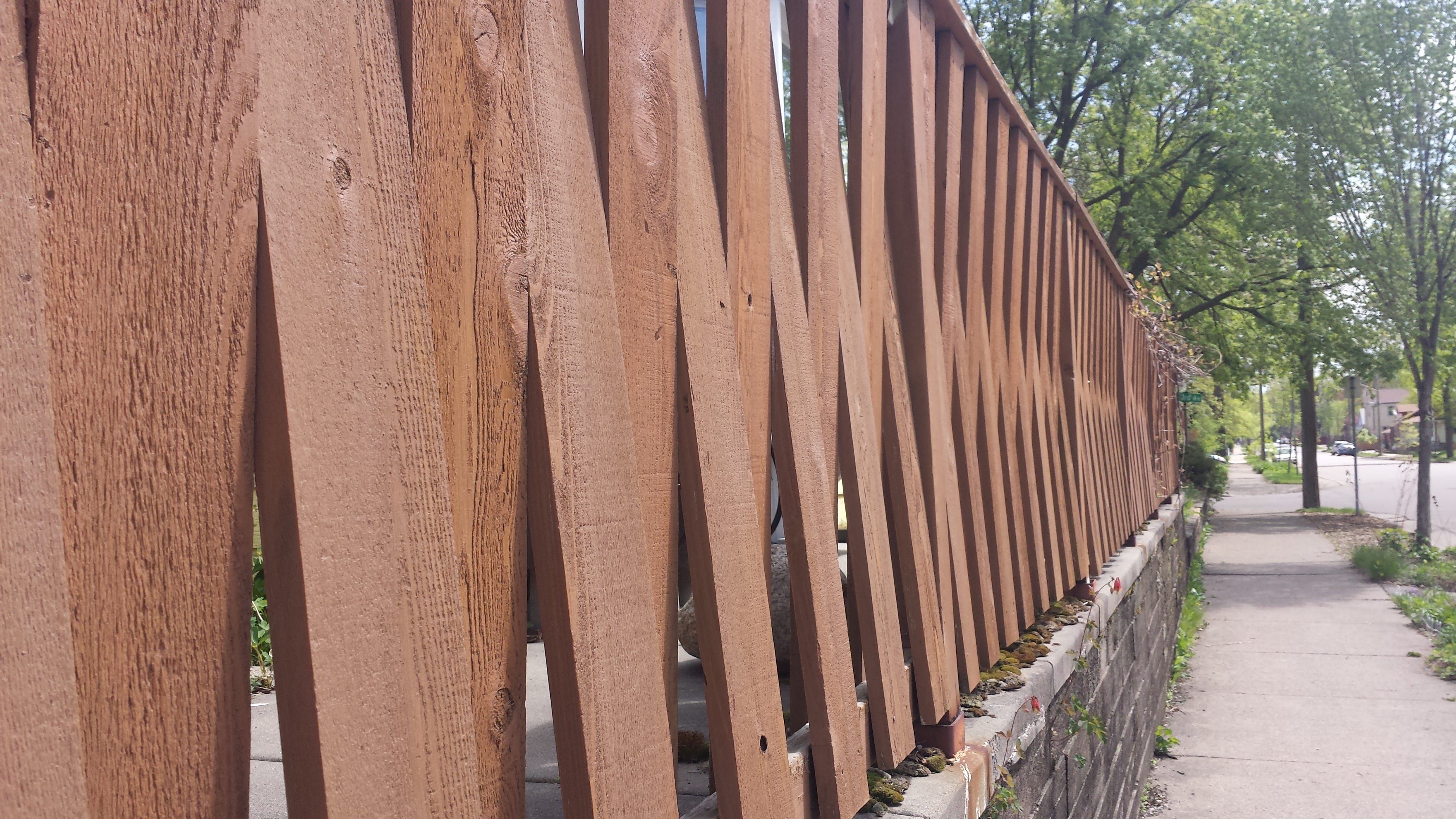
Turning east on 35th Street East, I spotted one of those little details that makes me glad for open eyes. Someone cleverly realized their fence boards had enough elasticity that they could be attached to the inside of the top stringer and the outside of the bottom stringer, or vice versa. By alternating the two arrangements, they created a striking visual effect.

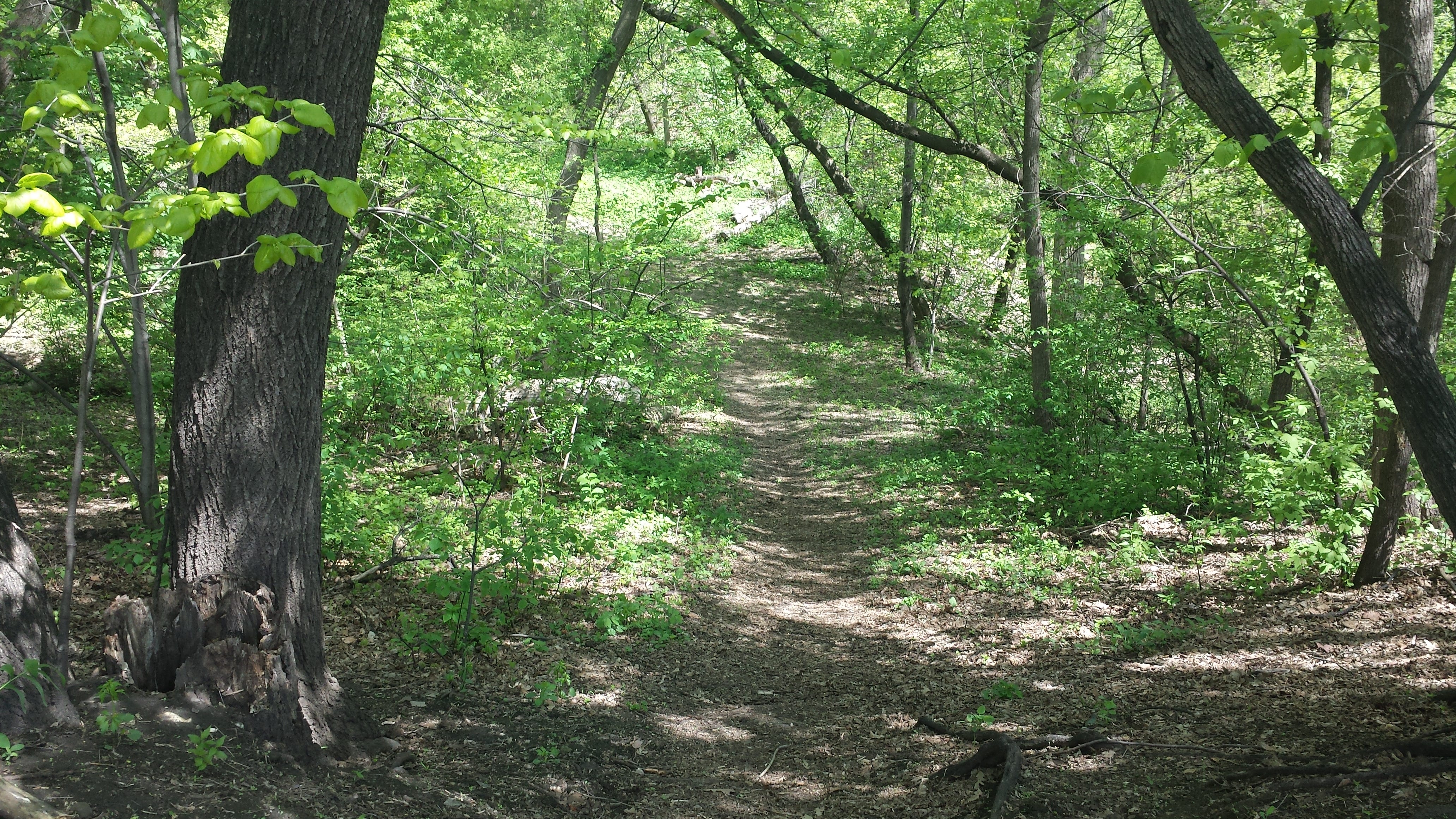
A handful of blocks further east on 35th Street East, it tees into 47th Avenue South, which lead me to Park Terrace. You can instantly find Park Terrace on the map: it’s the street that encircles the oval area. That oval area is a small and completely undeveloped park, Seven Oaks Oval, which descends considerably below the surrounding grade. Local youth seem to have worn some informal paths into it. I know when I was a kid, this was my idea of paradise: a little secluded bit of wilderness in the city.

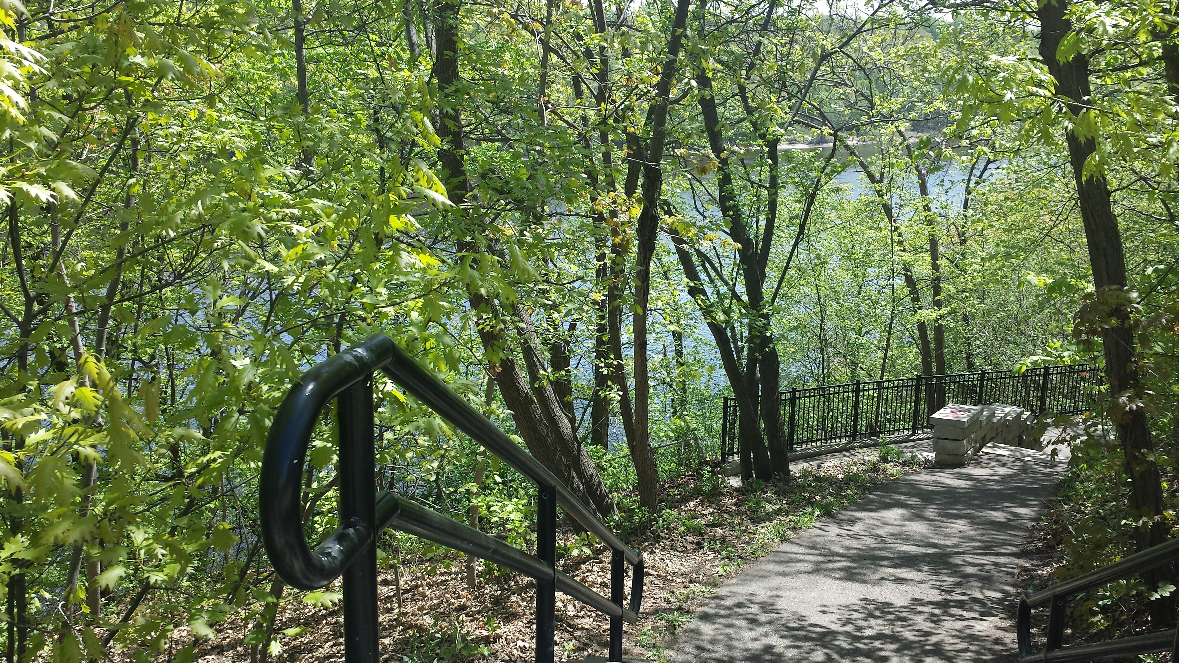
In the 3500 block of West River Parkway, a path from a parking area leads to the Drs. Dorothy & Irving Bernstein Scenic Rest Area. That’s also one of the places one can descend down the side of the river gorge to the lower, more rustic Winchell Trail. I continued on the paved pedestrian trail that generally runs along with the bicycle trail alongside the parkway, though for a portion of the 3400 block it separates and runs on a somewhat lower grade.

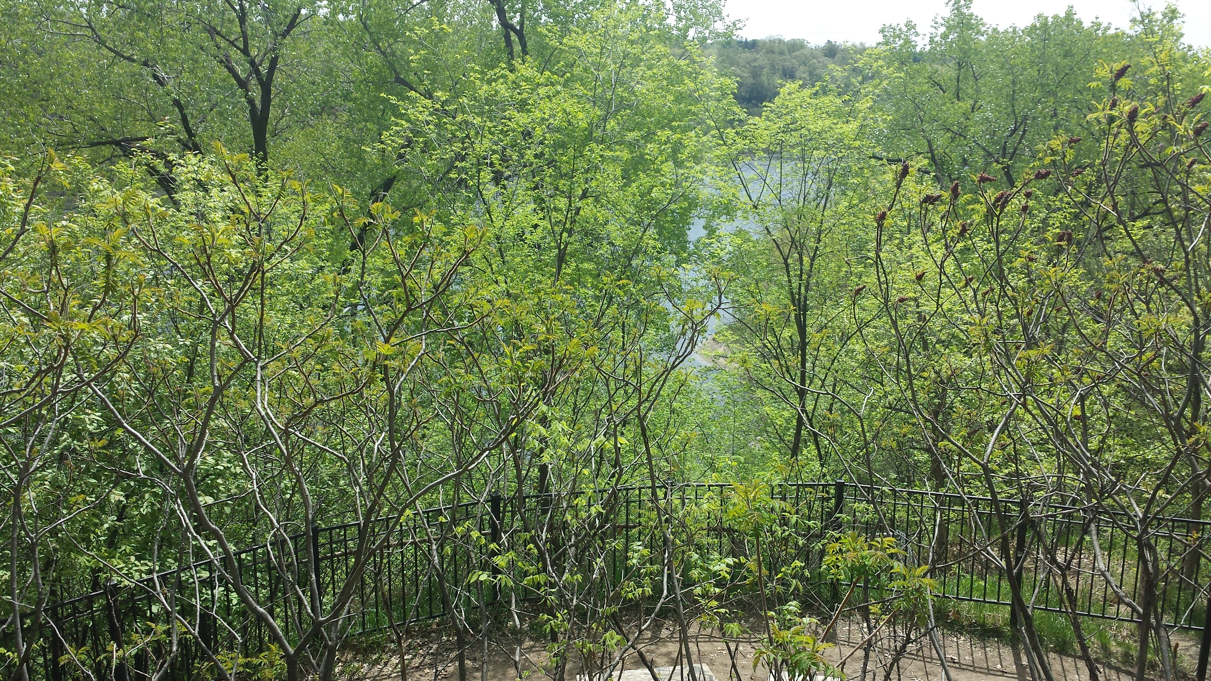

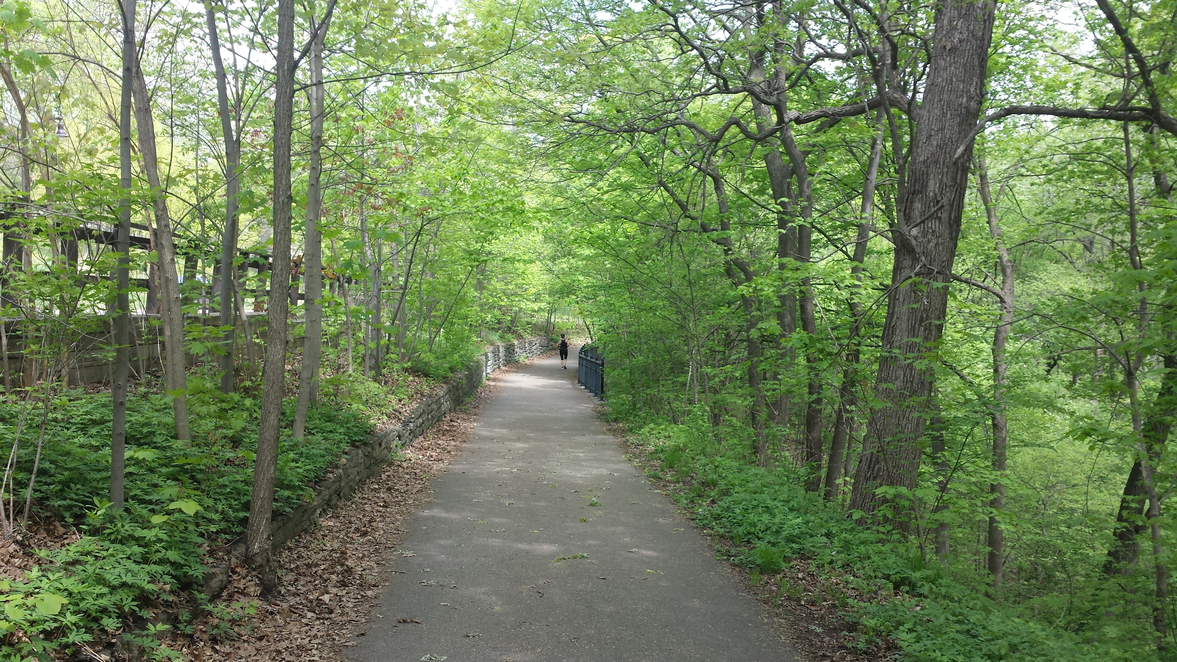
Once I reached the northern border of the neighborhood, across from 34th Street East, I did an about-face and walked back along the parkway all the way to the southern border, across from Folwell Drive. There I turned around again, returning to 38th Street, which (with some digression) took me back to my starting point. At 38th Street there is another stairway that leads partway down the river bluff from the parkway trail to the Winchell Trail. I’ll leave you with this view down the stairway toward the river, which I hope you find as inviting as I do.